
Introduction
Computer-aided design plays an important role in modern engineering, architecture, surveying, and infrastructure development. Professionals working with complex CAD drawings regularly perform tasks such as managing project files, calculating dimensions, checking object properties, editing geometry, and preparing technical documentation. Although these operations are essential, handling them manually can consume considerable time during large projects.
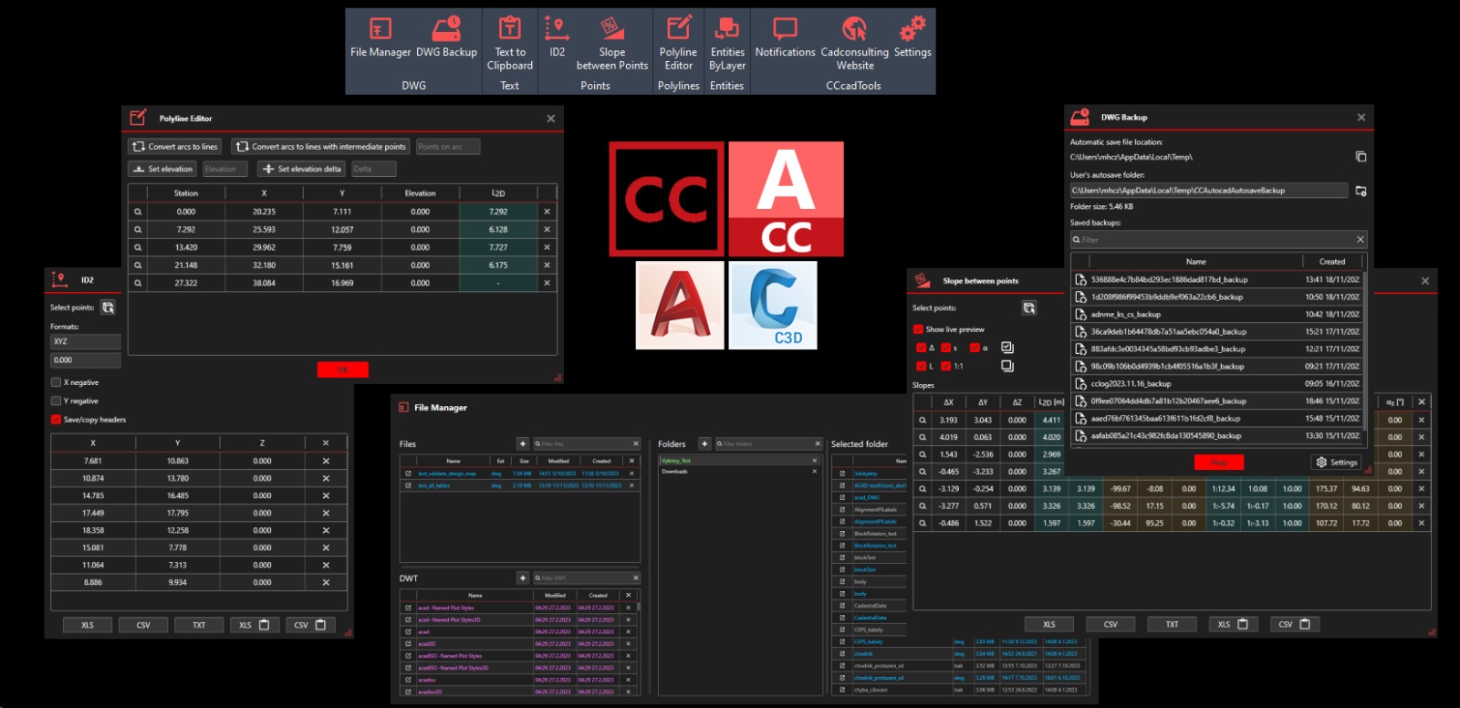
cadconsulting CCcadTools 1.2.2 is a productivity-focused extension designed for Autodesk AutoCAD and Civil 3D. It introduces a collection of practical utilities that simplify everyday drafting operations, improve drawing management, and support engineering calculations. Instead of replacing the existing CAD environment, it adds specialized commands that help users complete common tasks more conveniently.
The software is particularly useful for civil engineers, architects, CAD technicians, surveyors, and infrastructure designers who want to improve their existing AutoCAD workflows.
What Is CCcadTools 1.2.2?
CCcadTools is an add-on developed by cadconsulting for Autodesk AutoCAD-based applications. It integrates directly into the CAD interface and provides additional tools for managing drawings, working with coordinates, inspecting objects, and editing technical geometry.
Unlike standalone CAD applications, CCcadTools depends on a compatible Autodesk product to operate. Its functions are accessible through a dedicated ribbon after installation.
The extension combines general AutoCAD productivity features with additional tools developed specifically for Civil 3D users. This makes it relevant to both everyday drafting activities and specialized infrastructure design workflows.
Key Features of CCcadTools 1.2.2
1. File Manager for Drawing Organization
Managing multiple DWG files across different folders can become challenging when working on several engineering projects.
The File Manager provides an organized way to access drawings directly within AutoCAD. Users can add folders, open drawings, access templates, and pin frequently used files for faster access.
It also supports opening drawings in read-only mode, which is useful when reviewing project documents without accidentally modifying the original files.
2. DWG Backup and Recovery
Unexpected software errors or system interruptions can result in lost drafting progress. CCcadTools includes a DWG Backup utility that copies backup files from a temporary directory to a custom storage location.
This makes backup drawings easier to locate when recovery becomes necessary.
For professionals working on detailed architectural plans, engineering layouts, and infrastructure drawings, maintaining accessible backup files can provide an additional layer of project protection.
3. Clipboard History Integration
Moving information between Windows applications and AutoCAD is a regular part of technical drafting.
The Clipboard History feature improves this process by providing additional ways to transfer copied information into CAD drawings. Users can work with copied text, files, and supported AutoCAD entities.
For example, information copied from spreadsheets, documents, or emails can be transferred into a drawing without repeatedly switching between different applications.
This can make documentation and annotation tasks more convenient.
4. Text Formulas and Dynamic Calculations
One of the useful features of CCcadTools is its Text Formulas functionality.
It allows users to insert mathematical expressions into text entities and create references to other drawing objects. When referenced objects change, connected formulas can automatically recalculate.
This functionality can be useful for:
-
Length calculations.
-
Area measurements.
-
Quantity information.
-
Numerical drawing annotations.
-
Technical documentation.
By connecting text information with drawing objects, users can reduce the need for manually updating certain calculated values.
5. XList2 for Advanced Object Inspection
Complex AutoCAD drawings often contain nested objects inside blocks and external references. Examining their individual properties through standard commands can sometimes be difficult.
CCcadTools provides XList2, an enhanced version of AutoCAD’s traditional Xlist functionality.
It allows users to inspect properties of nested entities within blocks and external references. This provides additional information when reviewing complicated drawing structures, checking object layers, or investigating individual components.
6. Coordinate and Point Management
Coordinate information is important in surveying, civil engineering, construction, and infrastructure planning.
CCcadTools includes the ID2 command, which extends the standard AutoCAD ID functionality. Users can select multiple points and display their coordinates in a formatted table.
The collected information can be copied or exported into supported formats, including:
-
XLS
-
TXT
-
CSV
Another useful function is Slope Between Points, which provides information such as distance, slope, ratio, and angle between selected points or polyline segments.
These tools can simplify routine measurement and coordinate-related activities.
7. Geometry and Polyline Editing Tools
CCcadTools includes several utilities for working with drawing geometry and performing common drafting operations.
Some notable tools include:
-
Total Length: Calculates the combined length of selected objects.
-
Total Area: Determines the area of selected drawing elements.
-
Curve to Polyline: Converts supported curved objects into polylines.
-
Perpendicular from Curve: Creates perpendicular lines from selected curves.
-
Polyline Editor: Provides information about polyline vertices, coordinates, elevations, and related properties.
-
Align Text: Adjusts text position and rotation according to a selected curve.
These functions can help CAD professionals complete repetitive geometry operations more efficiently.
Civil 3D Features for Infrastructure Design
In addition to its general AutoCAD utilities, CCcadTools provides specialized functions for Autodesk Civil 3D. These features are particularly useful for road engineering, surveying, surface modeling, and infrastructure documentation.
1. Surface Modeling and Milling Operations
The Milling and Stripping utility helps users create or update surfaces using selected polylines and elevation information.
It can support workflows involving pavement removal, surface preparation, and road rehabilitation projects.
Users can work with existing surfaces or create new ones according to their project requirements.
2. Alignment and Profile Analysis
Road design projects frequently require information about alignment geometry and profile slopes.
CCcadTools includes dedicated tools for checking radius values at selected alignment stations and examining profile slopes.
These functions allow engineers to access useful design information without performing every calculation manually.
3. Corridor Point Generator
Corridor models contain important geometric information used in road and infrastructure projects.
The Corridor Point Generator allows users to extract point information from selected corridor stations and export the results into formats such as CSV, Excel, and DWG.
This can be useful for additional calculations, construction documentation, and project coordination.
4. Volume Table Generation
Earthwork quantities are an important part of infrastructure planning and construction estimation.
The Volume Table utility helps users prepare volume information from selected sample lines, stations, and data sources.
The resulting information can be exported into spreadsheet formats for further analysis and reporting.
5. Automated Road Markings
Preparing road markings manually can involve repetitive drawing operations, particularly in large transportation projects.
CCcadTools provides a Road Markings function for creating 2D and 3D road markings, including lines, arrows, symbols, and text.
The tool can also add extended data to 3D objects for BIM-related workflows, helping organize additional project information.
Benefits of Using CCcadTools 1.2.2
CCcadTools brings several practical utilities into one integrated CAD environment.
Improved Productivity: Dedicated commands can reduce repetitive drafting and documentation work.
Better Drawing Management: File Manager and DWG Backup help users organize project files and maintain accessible backup copies.
Simplified Calculations: Coordinate, slope, length, and area tools make common measurement tasks easier to perform.
Dynamic Text Information: Text Formulas can automatically update selected calculated annotations when referenced drawing objects change.
Detailed Object Inspection: XList2 provides additional visibility into nested entities within blocks and external references.
Infrastructure Support: Civil 3D tools assist with surface operations, alignment analysis, corridor point extraction, volume reporting, and road markings.
System Compatibility and Installation
CCcadTools 1.2.2 is an extension for Autodesk AutoCAD-based applications rather than an independent CAD program.
Its supported platforms include:
-
Autodesk AutoCAD
-
AutoCAD Architecture
-
AutoCAD Mechanical
-
AutoCAD Electrical
-
AutoCAD MEP
-
AutoCAD Map 3D
-
AutoCAD Plant 3D
-
Autodesk Civil 3D
The developer lists support for AutoCAD versions from 2021 through 2027. However, users should verify compatibility with version 1.2.2 and their specific Autodesk installation before proceeding.
After installation, the extension integrates into the AutoCAD interface and makes its commands available through a dedicated ribbon.
A compatible Autodesk application is required to use its functions.
Who Can Benefit from CCcadTools?
CCcadTools can be useful for several professional groups:
-
Civil Engineers: For working with alignment information, surfaces, corridor data, and infrastructure calculations.
-
CAD Technicians: For organizing drawings, editing geometry, and managing technical documentation.
-
Architects: For improving drawing organization and performing routine CAD operations.
-
Surveyors: For handling coordinates, point information, and measurement-related tasks.
-
Infrastructure Designers: For preparing road layouts, volume information, and corridor documentation.
-
Engineering Consultants: For simplifying repetitive operations across different CAD projects.
Its practical value depends on the type of projects and the tools users regularly need.
Conclusion
cadconsulting CCcadTools 1.2.2 is a productivity-oriented extension for Autodesk AutoCAD and Civil 3D that combines drawing management, backup recovery, coordinate handling, dynamic text calculations, object inspection, and geometry editing tools.
Its additional Civil 3D capabilities make it particularly relevant to professionals working with road design, surface modeling, corridor information, volume calculations, and infrastructure documentation.
For engineers, architects, surveyors, and CAD technicians who regularly perform repetitive drafting operations, CCcadTools offers a convenient collection of utilities within the existing Autodesk environment. It can help create a more organized workflow while reducing the effort required for common technical tasks.
Our Paid Service
If you want to Purchase Cracked Version / KeyGen Activator /License Key
Contact Us on our Telegram ID :
Crack Software Policies & Rules:
Lifetime Activation, Unlimited PCs/Users,
You Can test through AnyDesk before Buying,
And When You Are Satisfied, Then Buy It.
 Sajeel Irfan