
Introduction
Marine surveying plays an important role in offshore construction, underwater exploration, pipeline planning, and seabed investigation. Survey professionals collect geophysical information to identify magnetic anomalies, examine underwater conditions, and support decisions before carrying out marine engineering projects. Accurate data collection and reliable positioning are essential throughout this process.
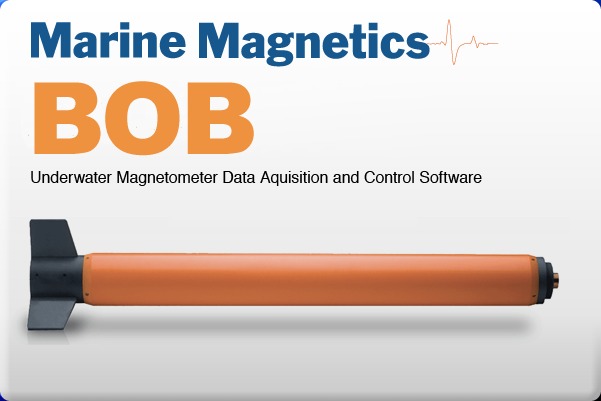
BOB Survey Software 8.5.1.668 is a specialized application developed for marine magnetometer survey operations. It supports workflows involving survey planning, magnetic data acquisition, navigation, real-time visualization, and review of collected measurements. Designed to work with compatible Marine Magnetics equipment, the software provides survey teams with tools for managing field data and examining magnetic readings.
Unlike general-purpose land surveying applications, BOB focuses on marine magnetic data and the equipment used to collect it. It is relevant to hydrographic surveyors, marine geophysicists, offshore contractors, and research teams working with underwater magnetic measurements.
Key Features of BOB Survey Software 8.5.1.668
1. Marine Magnetometer Data Acquisition
BOB provides a graphical interface for communicating with compatible marine magnetometers and recording incoming measurements. It can collect magnetic readings alongside GPS information and store the recorded survey data in an internal database.
Users can monitor the sampling status and review incoming measurements during field operations. This helps survey teams keep track of data collection and identify connection or recording issues.
2. Real-Time Magnetic Data Visualization
The software includes profile plotting tools that display incoming magnetic signals as graphs. Users can view multiple data channels, adjust individual scaling settings, and examine different sections of the collected measurements.
The profile display makes it easier to observe changes in magnetic readings while a survey is in progress. Users can also review previously collected data without necessarily interrupting current monitoring.
3. GPS Integration and Position Tracking
Accurate positioning is essential for marine geophysical surveys. BOB supports GPS connections through communication ports and uses positioning information to associate magnetic measurements with geographic locations.
Its GeoPlot window displays vessel and towfish positions, helping operators understand the relationship between the survey vessel and the towed magnetometer.
The software also provides navigation information that can help operators follow planned survey lines.
4. Survey Planning with Guide Grids
BOB includes a Guide Grid tool for preparing survey line arrangements before data collection begins.
Users can define survey grids, organize guide lines, and use background maps or reference images to plan the survey area. Existing guide grids can also be saved and imported for future projects.
This functionality is useful for maintaining organized survey coverage and helping vessel operators follow the intended route.
5. Towfish Layback Correction
When a magnetometer is towed behind a survey vessel, its actual position differs from the vessel’s GPS position. This difference is known as layback.
BOB provides layback configuration tools that account for towing distance and relevant equipment offsets. Its GeoPlot interface can display the vessel and towfish paths separately, helping users interpret the actual measurement locations more accurately.
Correct layback settings are important for reliable geographic positioning of collected magnetic data.
6. Survey Markers and Line Management
During marine surveys, operators may need to identify unusual readings, equipment events, or important locations.
BOB provides marker tools that allow users to add reference points to profile plots and geographic views. Survey lines can also be marked and organized for later examination.
These features help analysts identify important sections of a survey and maintain a clearer record of field observations.
7. Data Processing and Base Station Correction
Magnetic measurements can be affected by natural variations in Earth’s magnetic field. Base station correction helps account for these changes when suitable reference measurements are available.
BOB supports the import of base station data and provides correction workflows for reviewing magnetic survey measurements.
The software also supports survey line management and other data review operations that can help prepare collected information for further analysis.
8. Data Export and Project Backup
BOB provides options for exporting selected survey measurements and preserving complete project records.
Users can export selected data into CSV text files and choose which channels, columns, coordinate systems, and basic corrections should be included.
The software also supports MMS backup files, which package survey information and associated map data into a transferable project backup. GeoTIFF map export is available for supported workflows.
These options help survey teams preserve their work and transfer project information between compatible computers.
9. Dedicated GeoPlot Mapping Environment
The GeoPlot window provides a geographic view of marine survey operations. It includes tools for viewing vessel and towfish paths, working with guide grids, marking survey lines, and examining geographic positioning.
Users can customize map layers, adjust the display, and work with background maps to better understand the survey area.
This mapping environment is particularly useful when coordinating field navigation with magnetic data collection.
10. Optional BOB Analytic Module (BAM)
For users who require additional analytical capabilities, BOB supports an optional extension called the BOB Analytic Module (BAM).
BAM expands the standard software functionality with additional tools for:
-
Magnetic data interpolation
-
Magnetic mapping and surface visualization
-
Profile analysis
-
Data corrections
-
Target selection
-
Advanced anomaly examination
BAM requires a separate valid license. Its advanced analysis features should not be confused with the standard BOB installation.
Applications of BOB Survey Software
BOB is designed for marine magnetic survey workflows and can support several professional activities.
Underwater Archaeology
Marine archaeologists can use magnetic survey measurements to investigate potential submerged structures, shipwrecks, and other objects that may produce magnetic anomalies.
Offshore Pipeline and Cable Surveys
Survey teams working on offshore pipelines and cable routes can collect and review magnetic measurements along planned corridors. This information can contribute to seabed investigation and route assessment.
UXO Detection Surveys
Magnetometer surveys are used to investigate potential unexploded ordnance and other ferrous objects in marine environments. BOB can help collect and visualize the magnetic measurements used during these investigations.
Offshore Energy Projects
Offshore wind farms and other marine energy developments often require geophysical surveys before construction. Magnetic data can contribute to site investigation and the identification of potential metallic objects.
Marine Geophysical Research
Universities and research organizations can use BOB-supported survey workflows to collect, organize, and examine magnetic measurements for marine geological and geophysical studies.
Who Can Benefit from BOB Survey Software?
BOB is primarily intended for professionals and organizations involved in marine magnetometer operations.
-
Marine Geophysicists: For collecting and reviewing magnetic survey measurements.
-
Hydrographic Surveyors: For coordinating navigation and geophysical data collection.
-
Offshore Survey Contractors: For managing marine magnetic survey projects.
-
Marine Archaeologists: For investigating magnetic anomalies in underwater environments.
-
Offshore Engineering Teams: For supporting pipeline, cable, and energy infrastructure investigations.
-
Research Institutions: For conducting marine geophysical studies and field experiments.
The software is most useful when working with compatible Marine Magnetics equipment rather than as a general-purpose land surveying application.
System Requirements and Compatibility
BOB Survey Software is a Windows-based desktop application. According to the available product documentation, the software requires a compatible 64-bit Windows environment.
The published requirements include:
| Component | Requirement |
|---|---|
| Operating System | Windows 10 64-bit or newer |
| RAM | 8 GB or more |
| Storage | 4 GB or more |
| Processor | Intel Core i5 2.0 GHz or equivalent |
| Recommended Processor | Intel Core i5/i7, 8th generation or newer for demanding workflows |
| Display | HD resolution, with 1920 × 1080 recommended |
Additional requirements may apply depending on the connected magnetometer, GPS equipment, and optional BAM functionality.
Users should also check the appropriate Virtual COM Port drivers for their transceiver hardware and ensure that the required communication connections are configured correctly.
Important Considerations Before Installation
Before installing BOB Survey Software 8.5.1.668, consider the following points:
-
Confirm compatibility with your Windows operating system.
-
Check whether your magnetometer model is supported.
-
Verify GPS and communication port configurations.
-
Review the required transceiver drivers.
-
Ensure sufficient storage for survey databases and backups.
-
Confirm whether an optional BAM license is needed.
-
Keep backup copies of important survey projects.
BOB is designed to work with compatible marine magnetometer equipment. Installing the application alone does not replace the physical sensors and other hardware required for actual data acquisition.
Conclusion
BOB Survey Software 8.5.1.668 is a specialized marine geophysical application designed to support magnetometer survey planning, data acquisition, visualization, and processing. Its combination of GPS integration, magnetic profile plotting, guide grids, layback configuration, survey markers, and data export tools provides a dedicated environment for marine survey operations.
The software can be useful for hydrographic surveyors, marine geophysicists, offshore contractors, and research organizations working with underwater magnetic measurements. Its optional BOB Analytic Module further extends the platform with additional mapping and analytical capabilities.
For professionals involved in marine magnetometer surveys, BOB provides a focused workflow for managing field measurements and preparing survey information for further investigation.
Our Paid Service
If you want to Purchase Cracked Version / KeyGen Activator /License Key
Contact Us on our Telegram ID :
Crack Software Policies & Rules:
Lifetime Activation, Unlimited PCs/Users,
You Can test through AnyDesk before Buying,
And When You Are Satisfied, Then Buy It.
 Sajeel Irfan